
In September 2021, the Satellite Applications Catapult and The Coal Authority announced the start of a joint project funded by the Welsh Government. Monitoring of disused coal tips in South Wales using Earth Observation data is now underway. This article provides an update as the project moves into its second phase.
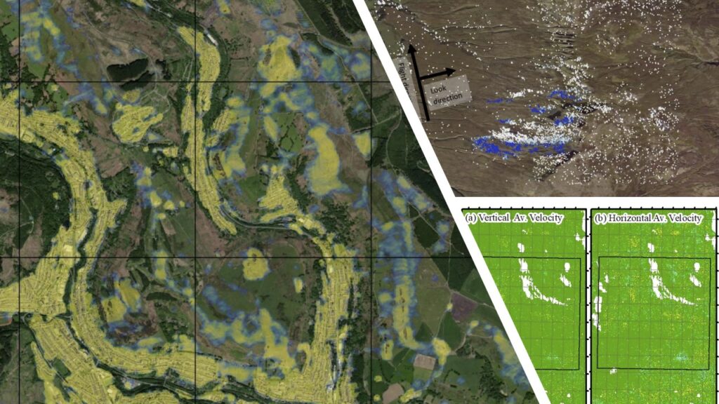
The Satellite Applications Catapult and The Coal Authority recently began monitoring disused coal tips in South Wales with the innovative use of satellite technology. The aptly named Coal Tips Monitoring Pilot project makes use of Synthetic Aperture Radar (inSAR) data to track changes in the environment in and around disused coal tips selected by The Coal Authority.
The Catapult, Earth Observation (EO) experts, put out a tender to the space industry, on behalf of the Welsh Government, which is funding this initiative as part of a series of technology trials for its Coal Tip Safety programme. Three EO specialist SMEs were recruited and began monitoring tips in September 2021. CGG, SatSense, and Terra Motion were chosen as leaders within their field, each offering a different methodology. The Catapult will analyse each company’s results to propose the most effective measure for future monitoring.
The Pilot project is split into three phases, with phase one of the project now complete. Work so far has focused on soil subsidence (sinking) and uplift (rising) – both crucial indicators for potential ground movement. Any movement within the ground has been measured with millimetre precision using three years of surface displacement estimation data. As is usually the case with remote sensing, vegetation and ground cover can make Earth Observation difficult. Less vegetation means more accurate measurements, and ground cover can also depend on recent activity. Fortunately for the teams, most of the target areas were without vegetation and were therefore easily measured.
Results suggest a promising framework for the future monitoring of coal tips using inSAR data. As the project moves into its second phase, corner reflectors are being sourced and installed on the ground to assist with further monitoring over an 8–12-month period. Corner reflectors act as a stable point of reference and will improve the accuracy of the satellite sensor measurements. This will help to determine whether monitoring can be improved.
Finally, in phase three, Earth Observation companies will evaluate the use of commercial space data and the improved accuracy of data based on the installed corner reflectors. This will help to understand the benefits corner reflectors could bring in relation to public safety and coal tip management.
The Satellite Applications Catapult, the Coal Authority and the Welsh Government are committed to implementing innovative solutions. This pilot project will assess innovations in satellite data with the aim of understanding disused coal tips better; to improve communities and environments and to reduce the risk to public safety.
Get In Touch
Do you want to find out more about this project? Get in touch with the Extractives Industries Team (Extractives@sa.catapult.org.uk) at the Satellite Applications Catapult.
