Driving Innovation in Delivery: Imperial’s Collaboration with the Satellite Applications Catapult
Marketing

Imperial College London’s Geotechnics Section are world-leading experts in satellite Interferometric Synthetic Aperture Radar (InSAR), for monitoring millimetric rates of Earth surface and structural deformation. This data is invaluable for engineers across various industries, such as energy, transport and civil engineering. As one of the first groups of researchers to downscale this radar remote sensing technique onto a drone – they’re providing a new and complementary data source to the existing fleet of Synthetic Aperture Radar (SAR) satellites, with higher resolution deformation mapping and improved operational flexibilities to target shadowed areas in the satellite data.
“The Drone Test and Development Centre proved to be the ideal location for us to test our novel drone radar system. I look forward to using the sensor test range, as these unique facilities will allow us to further validate our technology and results.”
Dr Anthony Carpenter, Postdoctoral Research Associate, Imperial College London.
“Working with the Catapult was smooth and efficient. We were able to conduct all our planned drone tests with ease, and I look forward to returning for future tests.”
Dr Stewart Agar, Postdoctoral Research Associate, Imperial College London.
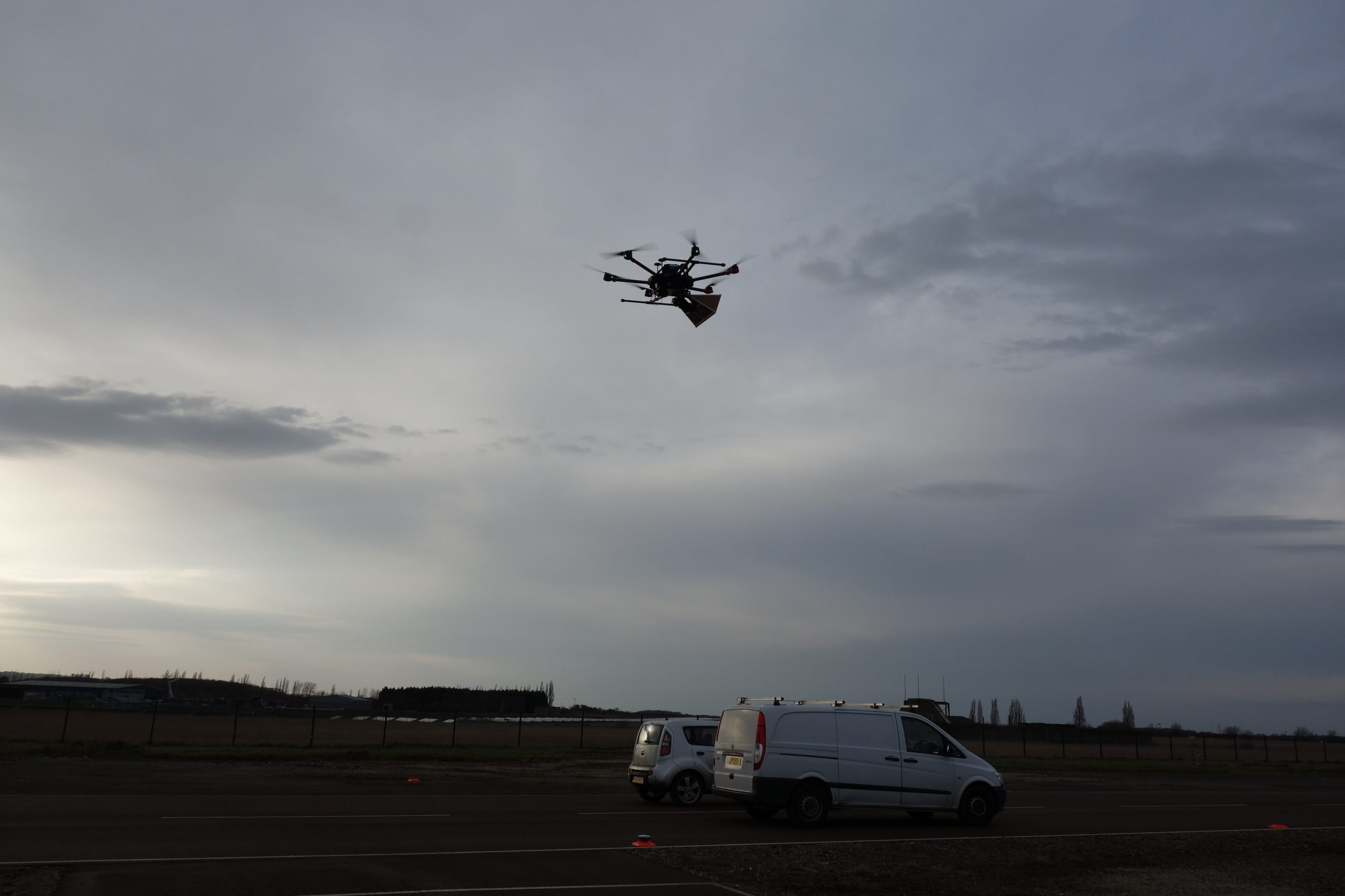
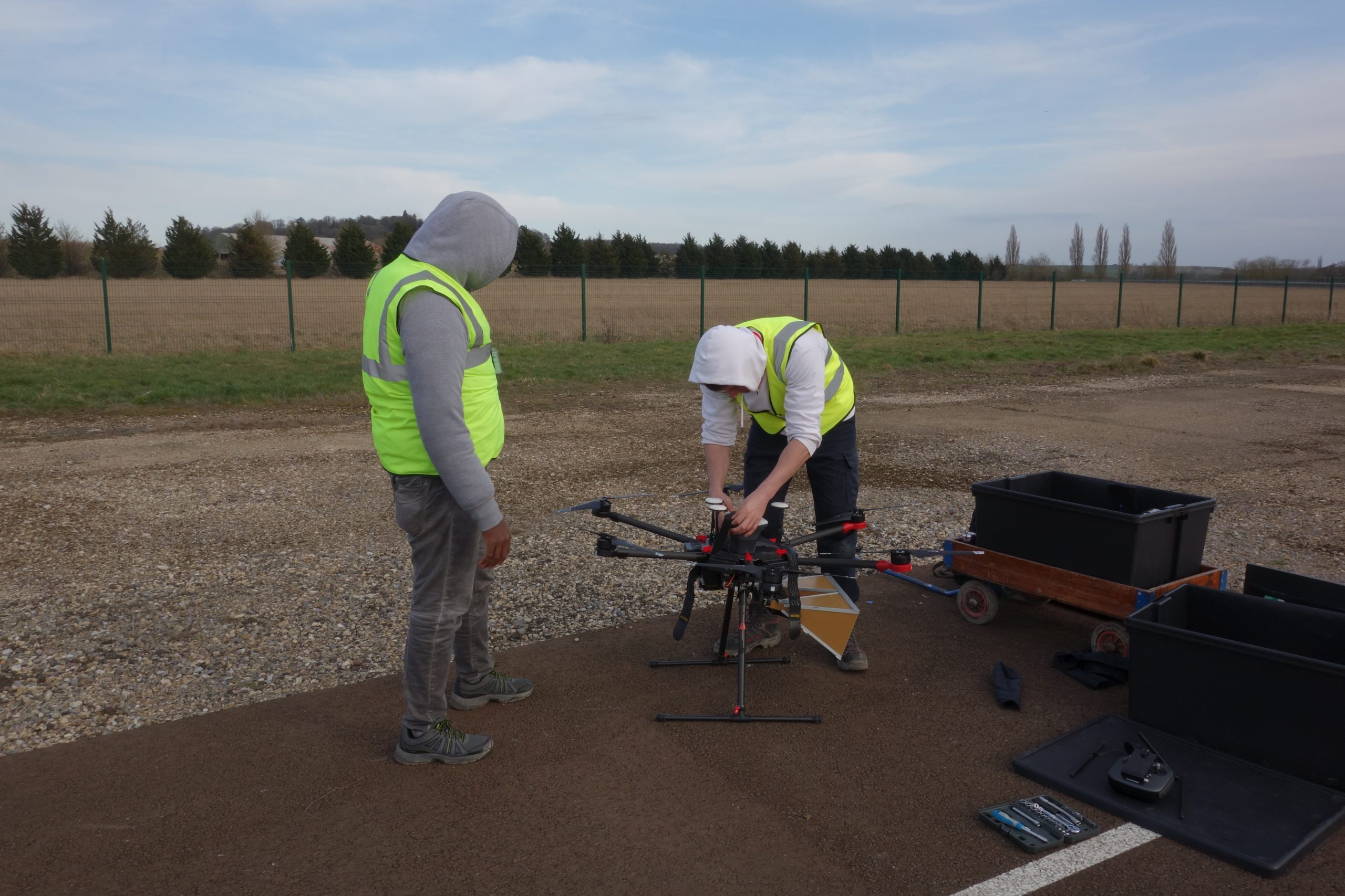
The drone sector is facing increasing pressure for accuracy in mapping and satellite data. Imperial’s drone radar system is a bespoke combination of hardware and software components that requires thorough testing before it can be deployed for repeat-pass data collection and InSAR processing. In particular, there are multiple hardware components which operate and communicate with each other through a series of wired and wireless connections. This includes the DJI Matrice 600 Pro flight controller, a Raspberry Pi 4, an Ettus USRP E312 Software Defined Radar (SDR), telemetry radios, and Global Navigation Satellite System (GNSS) receivers. Since the researchers at Imperial are based in London their location restricts drone flying and therefore testing would have to take place in a more secure and safe environment.
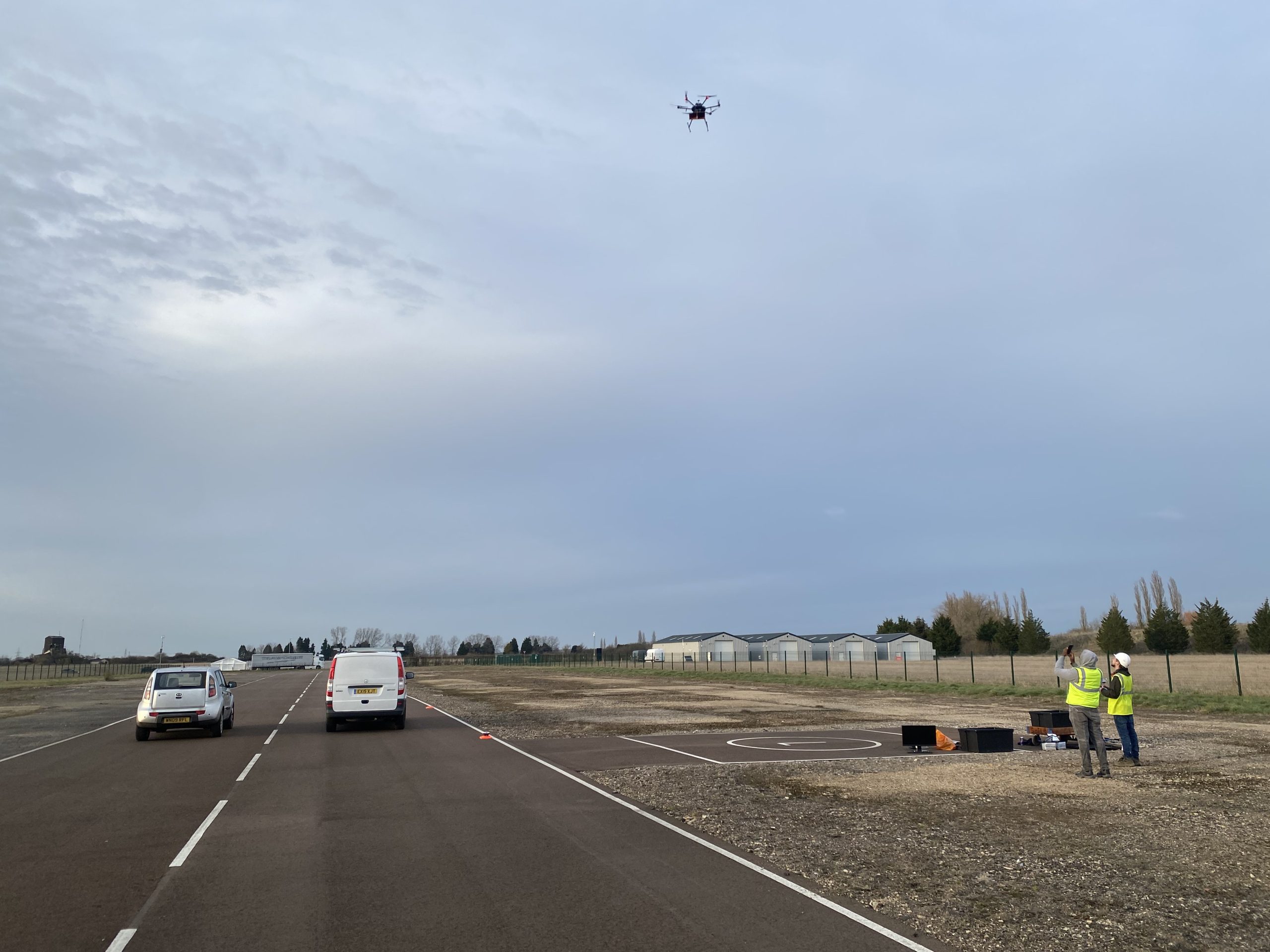
At the Drone Test and Development Centre, there are multiple open flying areas, no conflicting traffic, and a low residential density, so it is the idea location for Imperial to test their drone radar system. The facility’s capabilities helped Imperial to simplify their testing process by facilitating flights within the open category. The runway at the Drone Test and Development Centre was also significantly valuable when setting up this complex system and test the maximum effective range of the wireless data triggering and hardware communications.
A thorough facilities induction ensured that the testing was conducted safely. One test involved the maximum effective range of the wireless data triggering and hardware communications; the runway was an ideal site for this, given the large potential flying area. The mixed land-use (concrete, vegetation, infrastructure) provided useful contrast in the resultant SAR images.
The hardware and software testing was successful, with numerous automated flights and data collection. In the future, Imperial intend to use the adjustable corner reflectors at the sensor test range, to validate the deformation measurements collected by the drone radar system. The radar can image the reflectors, before moving them a known distance, imaging them again, and comparing how well the deformation results align. Validating InSAR is essential for proving the novel drone technology in academia and industry, and so the facilities are a huge benefit for the researchers at Imperial.
Once validated, the drone radar system will bridge the gap between ground-based and satellite sensors, thus strengthening the UK’s downstream geospatial services. Imperial and EDF Energy plan to integrate drone and satellite InSAR into a Structural Health Monitoring (SHM) system, for the long-term safety of nuclear energy sites undergoing decommissioning. This system could be applied to the monitoring of any Earth surface or infrastructure. Sentinel-1 satellite InSAR will provide site-scale to regional analyses, while drone InSAR offers a higher resolution of site-scale mapping for in-depth analysis. This includes follow-ups in areas of interest highlighted by the satellites, or shadowed areas from the satellite’s viewing geometry.