Space Applications
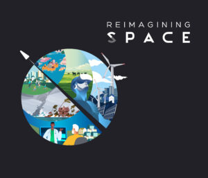
Reimagining Space: The Transformation of the Space Sector
Over the next three months, in a new series of blogs, videos and articles, we will be discussing how the UK space sector has been...
Over the next three months, in a new series of blogs, videos and articles, we will be discussing how the UK space sector has been...

“The Satellite Applications Catapult bravely leaves the technical stuff at the door when approaching bringing new innovations to business, instead focusing on solving the real...

As a high growth and high productivity sector, space launch offers a unique opportunity for the UK economy and job market; with the market for...

Contributors: Electra Panagoulia, Sarah Cheesbrough, and Cristian Rossi. At the start of lockdown earlier this year due to the COVID-19 pandemic, scenes of long queues...

There are huge opportunities and challenges facing the earth, from climate change and recovering from COVID to autonomy. Many of these are going to require...

In January 2020, the Satellite Applications Catapult published a detailed document which included 195 companies from across various sectors: outlining their products, services, and capability....

The Catapult’s position to support the uptake of satellite-enabled technology and solutions has never limited us to only using data from satellites. We acknowledge that...

Quantum computers threaten the security of the internet and secure communications. Current public key cryptography methods, such as RSA and ECC (see glossary below), could...

My research team at University College London uses big data analysis and computer models to convert large and cumbersome satellite observations of atmospheric composition into...

Connected and Autonomous Vehicles (CAVs) offer a range of future of exciting opportunities, not just as a new form of transport modality but also a...