Earth Observation DataHub
A single point of access to UK Earth Observation data and processing infrastructure
About the Hub
The purpose of the EODH is to deliver access to Earth Observation data for effective decision making across government, industry and academia. The hub aims to provide a standard set of services and Application Programme Interface’s (APIs). New EO services and tools can be developed and accessed from the hub platform. Being a UK focussed access point, the hub reduces the reliance on the limited access points to EO data that are currently available. A wide range of users are catered for, from those searching for EO data, to APIs for integrating into systems such as QGIS. The EODH brings open source and commercial EO data into one place, simplifying licensing and the overall process of accessing EO data.
Benefits of the EODH
Single point of access
Access EO data for research, government and industry use
Flexible
Enables EO data collective purchasing, reducing the need for multiple platforms and data stores
Fully tested
Co-designed with input from across the space sector
Authentic
Create credible and authoritative data and insights
What is on offer?
The Hub integrates data from public and commercial sources to offer a unified interface for discovering and accessing satellite-derived data.
What data can I access?
The Hub offers open-access datasets from public sources and research institutions such as Sentinel, UK Earth Observation Climate Information Service (EOCIS) and ESA Climate Change Initiative (CCI), as well as the capability to purchase commercial data from selected Planet and Airbus data collections. The data catalogue includes optical and RADAR imagery, climate observations, climate model projections, and land cover products.
Within the Hub, users can create workspaces and use the image visualisation tools and workflow engine to run analyses directly within the platform.
There are 3 applications available on the hub. These are:
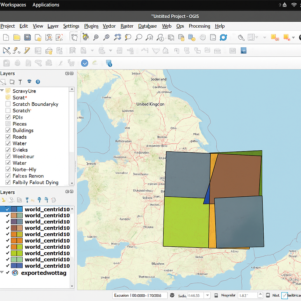
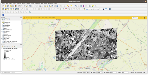
QGIS Plugin: QGIS plugin for intermediate users, produced by Oxidian. Enables EO data to be accessed within a GIS software. Additionally created a python API client, for easy access to the EODH APIs for developers.
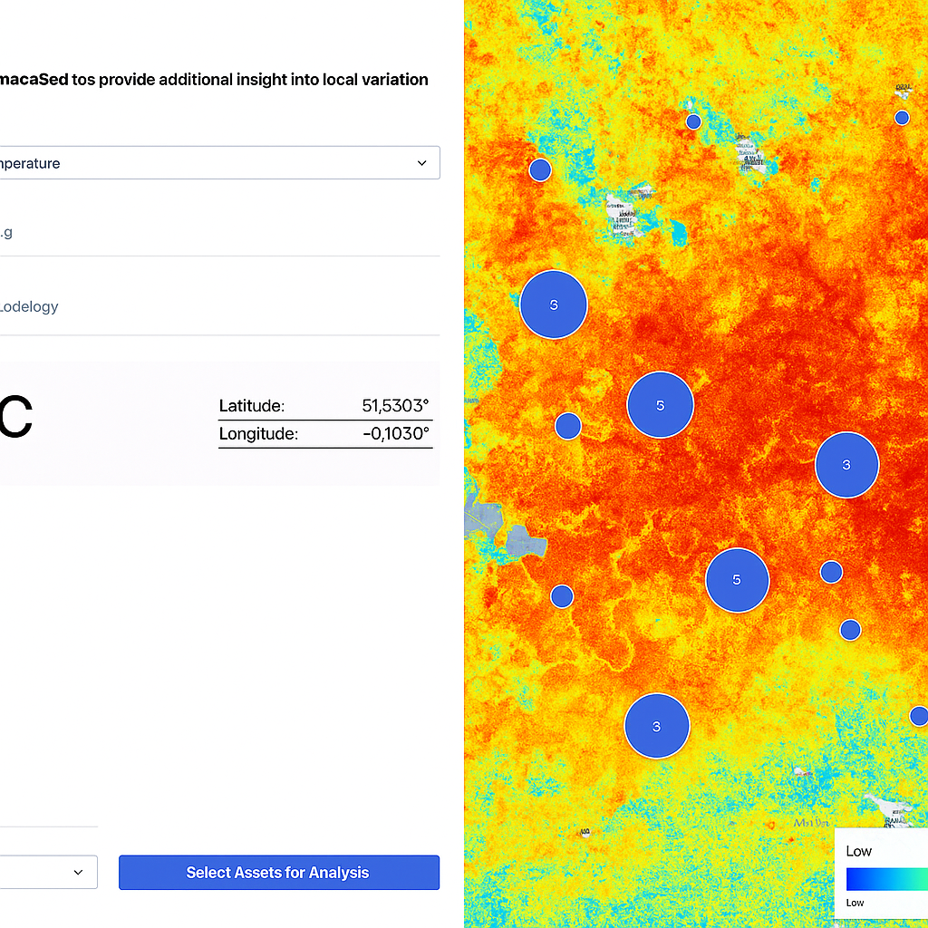
CLARAT (Climate Asset Risk Analysis Tool): No-code interface designed for entry-level to intermediate users, produced by Sparkgeo. Can be used to assess future exposure and vulnerability of physical assets to climate hazards. Derives hazard indicator datasets from climate projections stored on EODH.
EOPro: User-friendly platform for new and advanced users of EO data, produced by spyrosoft. Core feature is the Action Creator, a tool for creating customised workflows for processing EO data.
Case Study Highlight
Supporting measurements of Biodiversity Net Gain, Dalcour Maclaren
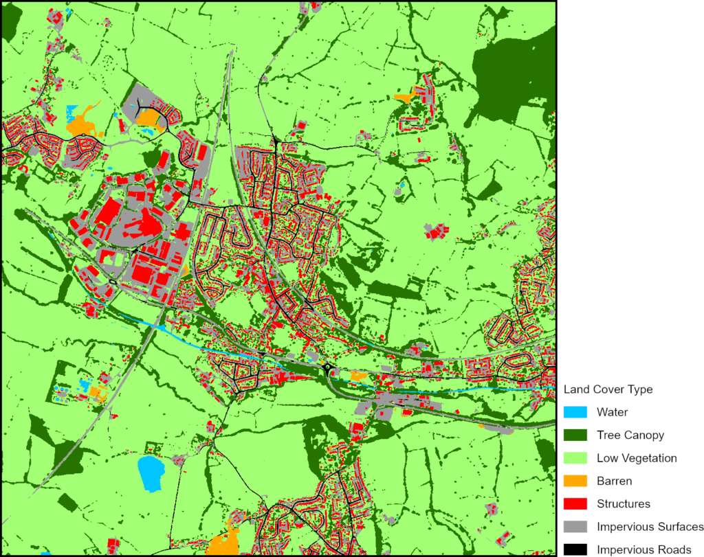
Dalcour Maclaren used high resolution commercial satellite imagery, obtained via the EODH, to investigate habitat monitoring for Biodiversity Net Gain (BNG). BNG is a legal requirement, under the Environment Act 2021, for developers in England to deliver at least a 10% enhancement on habitats. Utilising a deep learning model available in ArcGIS Living Atlas, they analysed habitat classification in an area of interest near Stonehouse, Gloucestershire (Figure 1).
Our Partners
The project is supported by key stakeholders UK Research and Innovation Natural Environment Research Council, Department for Science, Innovation and Technology, and UK Space Agency. A team of partners across the public and commercial sector have worked to produce the hub. Within the project delivery team, the Satellite Applications Catapult worked alongside the National Centre for Earth Observation and the Centre for Environmental Data Analysis, who are leading the project.
Get in touch
If you want to access Earth Observation data, the Earth Observation Data Hub is the single point of access to UK Earth Observation data and processing infrastructure you are looking for. To find out more, contact the EODH helpdesk.