Autonomous & Connected Earth

A Circularly Polarized Low-Cost Flat Panel Antenna Array with a High Impedance Surface Meta-Substrate for Satellite On-The-Move Medical IoT Applications
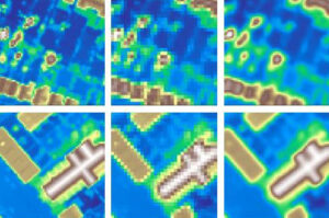
Catapult Co-Author: Thanos Arampatzis Abstract: A 1×3 linear antenna array consisting of Quad-Arm Curl antenna with a High impedance meta-surface (QACH) is presented. We believe...