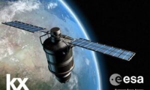
News and Comment

Autonomous & Connected Earth
Aerial view of a complex highway interchange with looping roads and surrounding buildings.

Route to Market Reports: Broadband to Vehicles 

This report covers the global Satellite Broadband to Vehicles sector, with an emphasis on the UK and European markets. The general technologies covered include the...

Autonomous & Connected Earth
Railway yard at dusk with lit overhead lights, multiple train tracks, and freight trains against a hilly backdrop.

Route to Market Reports: Broadband to Trains 

This market report focuses on satellite broadband to trains. The report looks at the existing and developing market for broadband services to passengers, staff and...

Logo with a world map labeled "In-Orbit Demonstration" and "IOD 5" text to the right.

Expanded opportunities for commercial products or services offered by In-Orbit Demonstration Programme Mission 5

The Satellite Applications Catapult is now inviting applications for the development of a dedicated satellite mission to trial technologies that will deliver a new commercial...

Autonomous & Connected Earth
Large cargo ship docked at a port with cranes and shipping containers under a clear blue sky.

Route to Market Reports: Broadband to Ships

This report covers the global shipping industry which includes vessels such as commercial ships, large fishing vessels, passenger, leisure marine, and larger privately owned or...

LSW logo with London Space Week text, featuring a Union Jack pattern on a dark blue background.

Satellite Applications Catapult sponsors London Space Week 2017

3 October 2017 – The Satellite Applications Catapult is taking part in the third edition of London Space Week (LSW), which takes place on 4-5...

Autonomous & Connected Earth
Airplane wing view on runway with another plane ahead under a partly cloudy sky.

Route to Market Report: Broadband to Aircraft

This market report assesses the use of broadband within aircraft, focusing specifically on applications which make use of digital connections. Click here to download >>

Autonomous & Connected Earth
Silhouetted satellite dishes under a starry night sky, aligned and facing upward.

Route to Market Reports: Galileo PRS

The Public Regulated Service (PRS) is a specific service provided by Europe’s GNSS, Galileo. Access to the PRS is granted by a Competent Authority in...

Providing Analytical Information to Assist in Galapagos Illegal Fishing Act

OceanMind Fisheries Analyst, Natalie Tellwright, explains how she and her colleagues have used use geospatial technology to help marine authorities investigate an illegal catch of over...

A cloud-based smart agriculture platform for India

Head of Earth Observation and the Agri Lead at the Satellite Applications Catapult, Mark Jarman, considers the challenges facing farmers in India, and highlights the...

Logos for Catapult Satellite Applications and OxLEP with respective taglines.

Oxfordshire’s Tech Cluster a Lynchpin For UK Economy’s Competitiveness On Global Stage – Says Key Report

Quantum computers, autonomous vehicles, digital health and space and satellites all identified as key strengths of Oxfordshire’s science and innovation ecosystem. Oxfordshire can play a...

Cargo ships with containers docked at a port under a cloudy sky, with cranes ready for unloading.

Catapult helps develop new AIS Sensor Network Service

The Satellite Applications Catapult is part of a team, led by exactEarth Europe, that has recently completed the demonstration project for a global maritime machine-to-machine...

Bathymetrics Data Portal

TCarta Marine and DHI group have announced the launch of The Bathymetrics Data Portal – an online shop that provides you with the best available...

1 39 40 41 54